WandR v1.0.1: A Ducati, a Reddit Question, and an AI Test at Union Station
A rider from Slovenia asked me if my AI trip planner actually suggested anything good. So while I was in DC on an errand, I opened WandR at Union Station and let it plan a scenic motorcycle route. Here's what it came back with — and the v1.0.1 update that made it smarter.
TL;DR
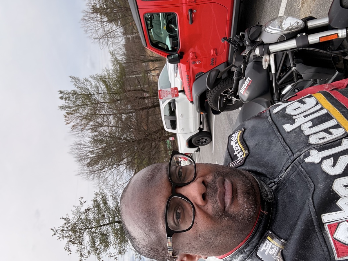
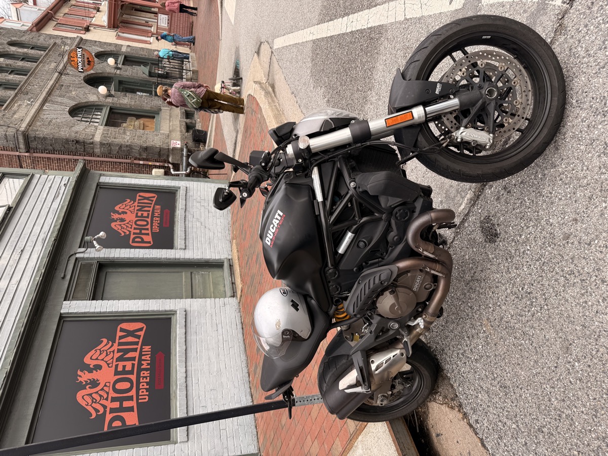
A Ducati rider from Slovenia asked me on Reddit today: “Did your app suggest anything good?” I’d just pushed WandR v1.0.1 with fixes that make the app smarter about understanding natural language and GPS. So while I was in DC on an errand, I pulled out my phone at Union Station, told WandR I wanted scenic spots for about four hours on a motorcycle, and let it plan a route. Five stops, 68 miles, a loop through Virginia — Great Falls, Manassas Battlefield, Burke Lake, and a covered bridge I didn’t know existed. This post is the answer to his question.
The Test: Union Station, DC
I was at Union Station on an errand. I had my phone. I had a question from a fellow Ducati rider sitting in the back of my head: “Did your app suggest anything good?”
So I opened WandR and gave it a real test:
“Scenic spots, being out for like around four hours, motorcycle”
Not a perfectly structured query. Just a normal human sentence with filler words, imprecise time framing, and no explicit start location. The kind of thing a real person says when they’re standing somewhere wondering where to ride.
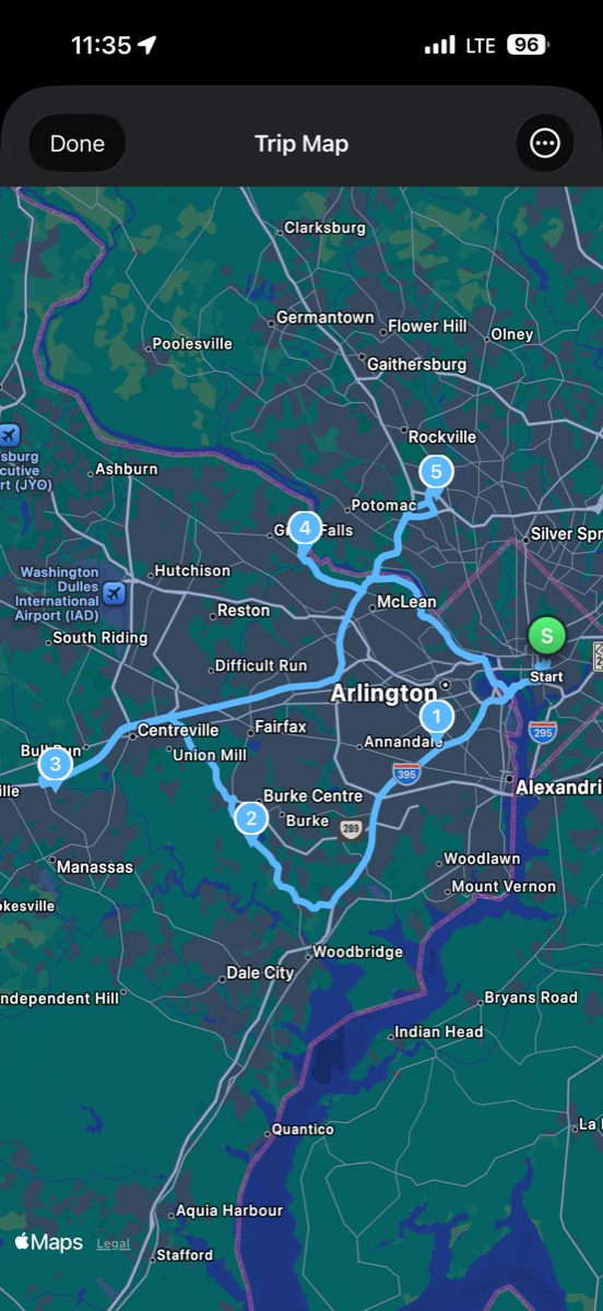
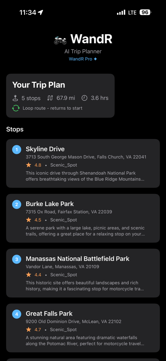
Within seconds, WandR came back with a 5-stop loop route:
- 67.9 miles total
- 3.6 hours (1.7 hours riding, 2.0 hours at stops)
- Loop route — starts and ends at Union Station
The Route It Planned
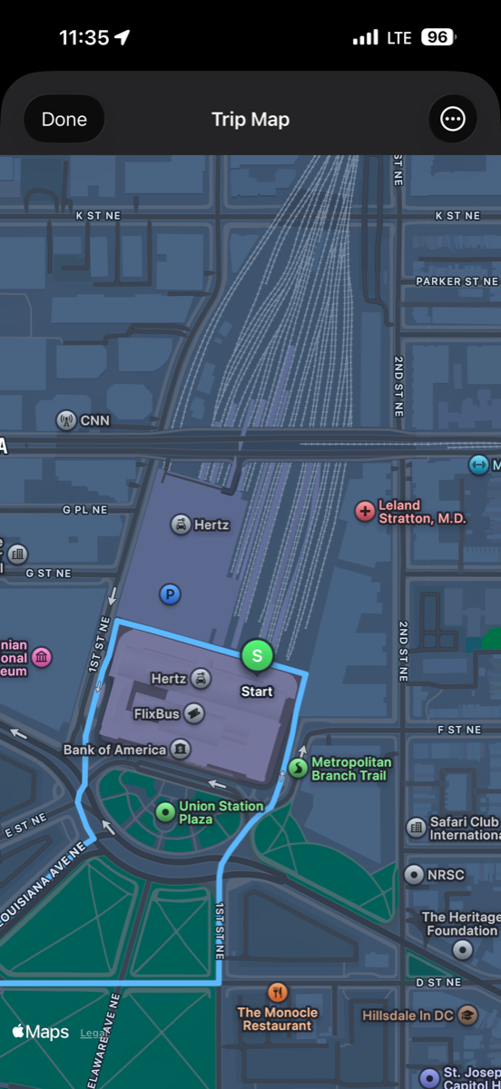
When I tapped “View on Map,” I got the full loop rendered on Apple Maps — real roads through Northern Virginia and Maryland.
Zoomed in to confirm — the start pin was right at Union Station.
Stop 1: Skyline Drive (Falls Church, VA) — 4.8
The gateway to Shenandoah. “Breathtaking views of the Blue Ridge Mountains.” On a motorcycle, this stretch is legendary — anyone who rides in the mid-Atlantic knows it.
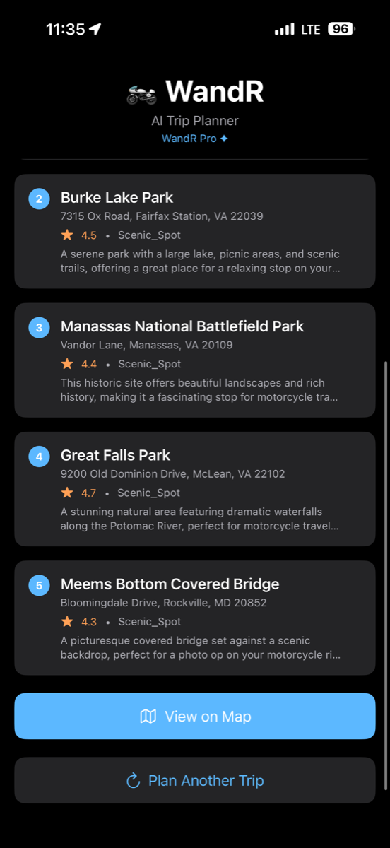
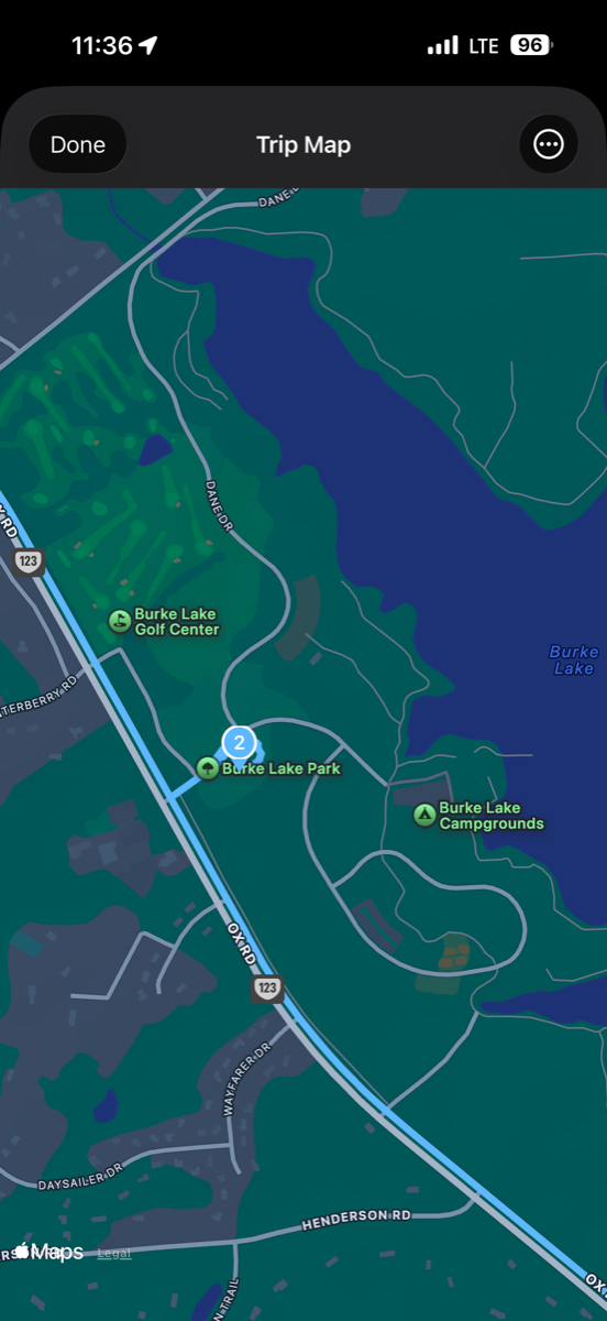
Stop 2: Burke Lake Park (Fairfax Station, VA) — 4.5
A serene lake with picnic areas and scenic trails. Good midpoint to stretch your legs and let the bike cool down.
Stop 3: Manassas National Battlefield Park (VA) — 4.4
Civil War history meets open countryside. The roads around Manassas are wide, clean, and perfect for a motorcycle.
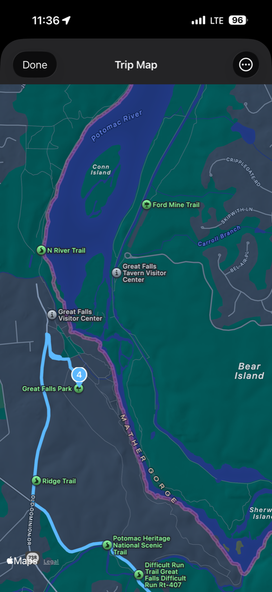
Stop 4: Great Falls Park (McLean, VA) — 4.7
Dramatic waterfalls along the Potomac River. The ride from Manassas to Great Falls takes you through some of the prettiest back roads in NoVA.
Stop 5: Meems Bottom Covered Bridge (Rockville, MD) — 4.3
A picturesque covered bridge. The kind of spot you’d never find unless you knew to look for it — exactly the kind of discovery that makes WandR different from just Googling “things to do near me.”
The AI was smart about the search. When you ask for scenic motorcycle stops, it doesn’t just dump the nearest parks from a database. It considers what’s actually worth riding to — places with views, good roads getting there, and enough character to make the stop worthwhile. Then it verifies each location against real map data to make sure the addresses are accurate and the places actually exist. It started with more candidates than I needed, filtered out anything too far for a 4-hour ride, and optimized the stop order to minimize backtracking.
How This Started: A Conversation on r/Ducati
The idea for WandR came from the Ducati community a few weeks ago. I’d posted a photo of my Monster 821 on a cold early ride, got great feedback, and started thinking: what if instead of picking a destination, you told an AI what you were in the mood for and let it figure out the rest?
Today, a rider from Slovenia posted on r/Ducati about his ride from Ljubljana to Monfalcone, Italy — twisties through the Vipava valley, beautiful 15-degree day. I asked about scenic stops along his route. He told me about the Kalce-Col-Ajdovscina road that sits on top of the valley with views to the left the whole way. Classic motorcycle storytelling — and he came back with fishing worms, which made the whole thing even better.
Then he asked me: “Where are you planning to go when the weather and roads clear up?”
And I told him the truth:
“It’s funny you ask that question… I live where you can easily go to Philadelphia, Delaware, Virginia within a 2 hour ride. But I wanted to think about it differently, so after getting some great feedback from the r/Ducati community on the day of my last ride I built an app to help me just ‘wander’ around — so I plan to just let the AI give me ideas of where to go based on how long I wanna be out and what I want to see.”
He’s a builder too. His response:
“Sprinkle some AI on the problem :) I see you’re a fellow builder, love to see it!”
He pitched me a feature idea — a “map my ride” mode, like Strava but for motorcycle rides. Track where you went, see it after the fact. Genuinely great idea, and it’s going on the roadmap.
But the question that mattered most was his last one:
“So, did your app suggest anything good?”
The Answer
Yes. Five real stops. Sixty-eight miles of back roads, national parks, waterfalls, and a covered bridge. All from standing at Union Station and saying “scenic spots, four hours, motorcycle.” No typing an address. No scrolling through lists. Just talking to it like you’d talk to a friend who knows the area.
Today’s Actual Ride: Maryland
I didn’t ride the Virginia route today — I was on my regular loop through Laurel, Columbia, and Ellicott City, Maryland. The DC stop was an errand that turned into a product test.
But the Union Station test gave me exactly what I needed: proof that when a fellow rider asks “does it actually work?” the answer is yes, and I can show the receipts.
What v1.0.1 Fixed
I pushed version 1.0.1 to the App Store yesterday — March 7, 2026. The fixes came from actually using the app on the road and listening to feedback. The core theme: the app should understand you the way a friend would, not the way a search engine does.
Your words matter. Version 1.0 would strip your natural language down to sterile keywords. “Scenic spots, being out for like around four hours” became "Find scenic_spots, 4 hours, motorcycle" — losing all the nuance. v1.0.1 preserves your original words so the AI can reason over what you actually meant.
Know where I am. Version 1.0 tried to geocode whatever text you typed. “From here” returned nothing useful. v1.0.1 uses GPS first — the app grabs your actual location without you typing an address.
Cleaner app. Removed dead code, tightened App Store compliance.
What Feedback Taught Me
Use your own product. Not in a simulator — on the road, in real conditions. The GPS fix and query preservation both came from real-world usage.
Listen to your community. The Ducati subreddit didn’t just give me motorcycle advice — the conversations there shaped the product. When a rider from Slovenia asks “did your app suggest anything good?” that’s user research wrapped in motorcycle culture. More honest than any survey.
Ship the fix, then test it. v1.0.1 went to the App Store yesterday. Today I tested it at Union Station. Tomorrow it handles the next rider’s query a little better than it would have last week.
The Strava-for-motorcycles idea? Going on the roadmap. Map your ride, see where you went, share it. That came from a conversation between two Ducati riders — one in Maryland, one in Slovenia — swapping stories on Reddit. That’s how good products get built.
Try It Yourself
WandR is free. Tell it what you’re in the mood for — breweries, scenic spots, restaurants, whatever. Tell it how long you want to be out and how you’re getting around. It handles the rest.
Download WandR on the App Store
Cheers, Fabian Williams
Links:
- WandR on the App Store — Free
- WandR Community Repo
- The r/Ducati thread
- Yesterday’s comeback post
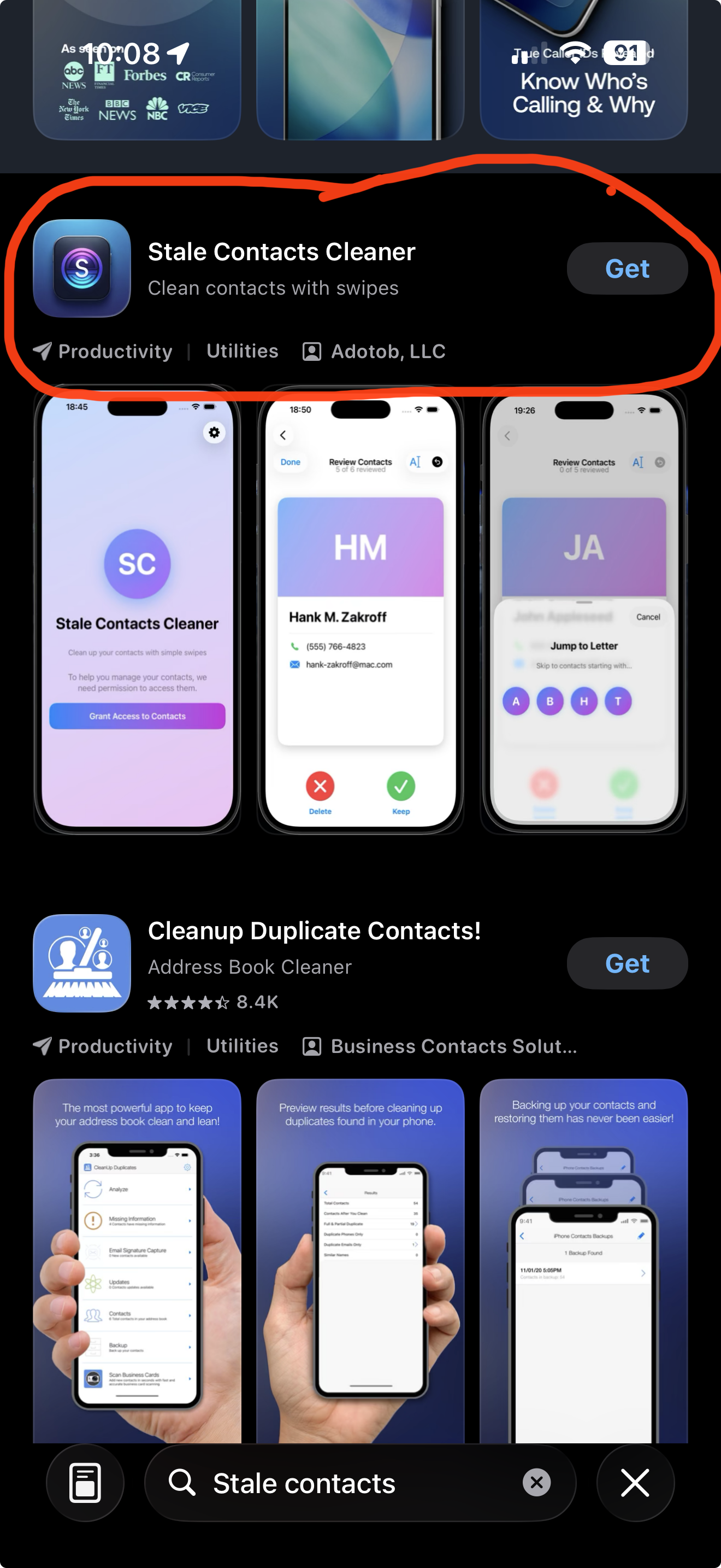
- Stale Contacts Cleaner — Free on the App Store
- All Products on adotob.com
- YouTube